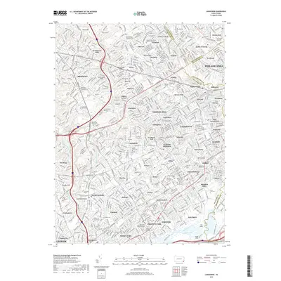
2019 Map of Lansdowne
USGS Topo · Published 2019About this map
Darby Creek and its many tributaries, including Whetstone Run and Lewis Run, define the rolling suburban landscape west of Philadelphia. This 2019 survey captures the densely settled corridor of Delaware and Montgomery counties, where long-established neighborhoods like Lansdowne, Drexel Hill, and Broomall are woven together by historic thoroughfares such as W Chester Pike and Baltimore Pike. The map is particularly rich in genealogical data, documenting a deep religious and civic heritage through numerous Quaker sites, including the Springfield Friends Burial Ground and the Old Haverford Friends Meeting House Cem. Significant institutional footprints are visible across the quadrangle, from the campus of Swarthmore College in the south to the Saint Charles Borromeo Seminary on the edge of Penn Wynne. Dozens of smaller cemeteries and memorial gardens, such as Mount Lebanon Cem and Saint Denis Cem, are meticulously located among the residential blocks.
Find a feature on this map
125 named features on this map. Tap any name to fly to it.
Don’t see what you’re looking for? This feature index may not catch every label — zoom into the map to look around manually.
Map Details
Editions of this 2019 Lansdowne Map
This is the sole edition of this map. No revisions or reprints were ever made.
Other maps of this area

1891 · Philadelphia
USGS Topo · 1:62,500

1893 · Germantown
USGS Topo · 1:62,500

1894 · Chester
USGS Topo · 1:62,500

1894 · Philadelphia
USGS Topo · 1:62,500

1894 · Norristown
USGS Topo · 1:62,500

1894 · Germantown
USGS Topo · 1:62,500

1895 · Norristown
USGS Topo · 1:62,500

1896 · Germantown
USGS Topo · 1:62,500

1896 · Philadelphia
USGS Topo · 1:62,500

1896 · Norristown
USGS Topo · 1:62,500