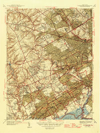
1946 Map of Lansdowne
USGS Topo · Published 1946About this map
Upper Darby and the surrounding townships in Delaware County show a landscape of rapid suburban expansion in this mid-century survey. Dense residential grids push westward from Philadelphia, surrounding established institutions like St Charles Borromeo Seminary and Swarthmore College. This era was defined by a transition from agricultural plots to planned neighborhoods like Drexel Hill and Chatham Village, though numerous green spaces remain in the form of private clubs such as Merion Golf Club and Aronimink Golf Club.
Find a feature on this map
129 named features on this map. Tap any name to fly to it.
Don’t see what you’re looking for? This feature index may not catch every label — zoom into the map to look around manually.
Map Details
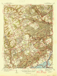
Editions of this 1946 Lansdowne Map
2 editions found
Other maps of this area

1891 · Philadelphia
USGS Topo · 1:62,500

1893 · Germantown
USGS Topo · 1:62,500

1894 · Chester
USGS Topo · 1:62,500

1894 · Philadelphia
USGS Topo · 1:62,500

1894 · Norristown
USGS Topo · 1:62,500

1894 · Germantown
USGS Topo · 1:62,500

1895 · Norristown
USGS Topo · 1:62,500

1896 · Germantown
USGS Topo · 1:62,500

1896 · Philadelphia
USGS Topo · 1:62,500

1896 · Norristown
USGS Topo · 1:62,500