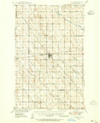
1948 Map of Lansford
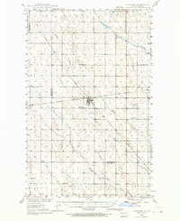
USGS Topo · Published 1968About this map
Lansford sits at the heart of this agricultural survey, serving as a critical rail junction where the Minneapolis St Paul and Sault Ste Marie crosses the Great Northern line. The surrounding landscape in Bottineau and Renville counties is defined by a dense network of country school districts and small prairie settlements like Truro and Forfar. The terrain is carved by glacial drainage patterns, including Little Deep Creek and Spring Bank Creek, which wind through the township grids. Local life in the late 1940s is reflected in the placement of rural landmarks such as Blaine Sch, Mount Rose Sch, and Lansford Cem. Numerous gravel pits scattered across the map suggest the ongoing importance of road building and local infrastructure during the post-war development of the Missouri River Basin.
Find a feature on this map
23 named features on this map. Tap any name to fly to it.
Don’t see what you’re looking for? This feature index may not catch every label — zoom into the map to look around manually.
Map Details
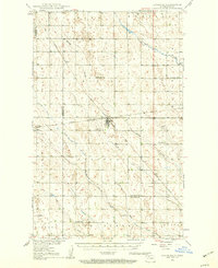
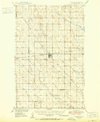
Editions of this 1948 Lansford Map
3 editions found