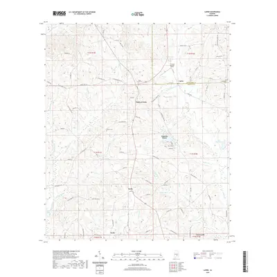
2020 Map of Lapine
USGS Topo · Published 2020About this map
Lapine and Highland Home anchor this rural landscape straddling the Montgomery and Crenshaw county line. The terrain is defined by a complex network of waterways, including Little Patsaliga Cr and Pintala Cr, which carve through the countryside alongside small communities like Sardis and Saville. This survey provides a modern view of the area's established residential and agricultural patterns, highlighting the persistence of historic landmarks such as Rocky Mount Cem and Old Philadelphia Cem.
Find a feature on this map
96 named features on this map. Tap any name to fly to it.
Don’t see what you’re looking for? This feature index may not catch every label — zoom into the map to look around manually.
Map Details
Editions of this 2020 Lapine Map
This is the sole edition of this map. No revisions or reprints were ever made.
Other maps of this area

1953 · Montgomery
USGS Topo · 1:250,000

1953 · Andalusia
USGS Topo · 1:250,000

1956 · Montgomery
USGS Topo · 1:250,000

1957 · Montgomery
USGS Topo · 1:250,000

1957 · Andalusia
USGS Topo · 1:250,000

1957 · Letohatchee
USGS Topo · 1:62,500

1968 · Petrey
USGS Topo · 1:24,000

1968 · Grady
USGS Topo · 1:24,000

1971 · Fullers Crossroads
USGS Topo · 1:24,000

1971 · Honoraville
USGS Topo · 1:24,000