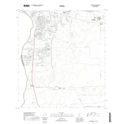
2019 Map of Laredo South
USGS Topo · Published 2019About this map
The Rio Grande serves as the international boundary between the United States and Mexico, shaping the western edge of this south Texas landscape. Along this border, the southern reaches of Laredo are characterized by a dense network of residential streets and distinct colonias. These established communities, including Larga Vista and One River Place Colonia, are situated near water features like San Ildefonso Creek and Link Lake Number 2. The map highlights the intersection of modern municipal growth and the arid terrain typical of Webb County, where managed water sources such as the Rafael B Garcia Reservoir and San Ramon Fish Pond are essential landmarks. To the east, the settlement pattern shifts toward more dispersed developments like Los Altos Colonia and Tanquecitos South Acres II, illustrating the outward expansion of the border region during the late twenty-first century.
Find a feature on this map
92 named features on this map. Tap any name to fly to it.
Don’t see what you’re looking for? This feature index may not catch every label — zoom into the map to look around manually.
Map Details
Editions of this 2019 Laredo South Map
This is the sole edition of this map. No revisions or reprints were ever made.
Other maps of this area

1933 · Becerra Creek
USGS Topo · 1:62,500

1956 · Islitas
USGS Topo · 1:62,500

1956 · Laredo East
USGS Topo · 1:62,500

1956 · Laredo
USGS Topo · 1:250,000

1965 · Laredo West
USGS Topo · 1:24,000

1965 · Tios Creek
USGS Topo · 1:24,000

1965 · Laredo East
USGS Topo · 1:24,000
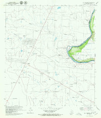
1979 · Isla Mesteno
USGS Topo · 1:24,000

1979 · Laredo South
USGS Topo · 1:24,000

1979 · O'Keefe Lake
USGS Topo · 1:24,000
Featured Places
- Laredo, TX
- La Presa, TX
- Tanquecitos South Acres Colonia, TX
- Los Altos Colonia, Laredo
- Old Milwaukee West Colonia, TX