
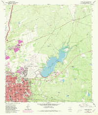
1965 Map of Laredo East
USGS Topo · Published 1967About this map
Laredo Air Force Base dominates the central landscape of this mid-1960s survey, showing the facility as it functioned just prior to its deactivation. The airfield is flanked by the burgeoning residential grid of Laredo and the recreational waters of Casa Blanca Lake, illustrating a period of significant post-war expansion along the Rio Grande corridor. The urban layout is densely packed with educational and religious institutions, including St. Joseph Academy and Ursuline Academy, alongside the sprawling Catholic Cem and City Cem.
Find a feature on this map
65 named features on this map. Tap any name to fly to it.
Don’t see what you’re looking for? This feature index may not catch every label — zoom into the map to look around manually.
Map Details
Editions of this 1965 Laredo East Map
2 editions found
Other maps of this area

1933 · Becerra Creek
USGS Topo · 1:62,500

1956 · Islitas
USGS Topo · 1:62,500

1956 · Laredo East
USGS Topo · 1:62,500

1956 · Laredo
USGS Topo · 1:250,000

1965 · Laredo West
USGS Topo · 1:24,000

1965 · Orvil
USGS Topo · 1:24,000

1965 · Cuervo Creek
USGS Topo · 1:24,000

1965 · Cibolo Ranch
USGS Topo · 1:24,000

1965 · Tios Creek
USGS Topo · 1:24,000

1979 · Laredo South
USGS Topo · 1:24,000