
1965 Map of Cibolo Ranch
USGS Topo · Published 1967About this map
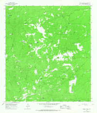
Cibolo Ranch serves as the focal point for this 1960s survey of South Texas rangeland, where the scarcity of surface water shaped every aspect of human presence. Life and industry in this portion of Webb County revolve around a network of engineered watering holes and deep groundwater access. Named reservoirs like Kuykendall Tank, Callaghan Tank, and Borregos Tank dot the landscape, providing essential resources for livestock in a territory defined by Chacon Creek and San Ygnacio Creek.
Find a feature on this map
29 named features on this map. Tap any name to fly to it.
Don’t see what you’re looking for? This feature index may not catch every label — zoom into the map to look around manually.
Map Details
Editions of this 1965 Cibolo Ranch Map
2 editions found
Other maps of this area

1937 · Aguilete Creek
USGS Topo · 1:62,500

1956 · Becerra
USGS Topo · 1:62,500

1956 · Laredo East
USGS Topo · 1:62,500

1956 · Webb
USGS Topo · 1:62,500

1956 · Laredo
USGS Topo · 1:250,000

1965 · Orvil
USGS Topo · 1:24,000

1965 · Tios Creek
USGS Topo · 1:24,000

1965 · Laredo East
USGS Topo · 1:24,000
1980 · Callaghan Ranch SE
USGS Topo · 1:24,000
1980 · Burrito Tank
USGS Topo · 1:24,000