
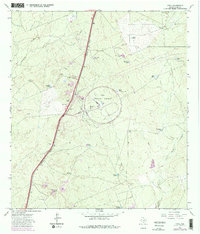
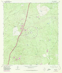
1965 Map of Orvil
USGS Topo · Published 1967About this map
The Tire Proving Ground dominates this mid-1960s landscape, featuring a large circular track and an Observation Tower central to its operations. This specialized industrial footprint is set against a backdrop of traditional ranching infrastructure in Webb County. The presence of numerous named water tanks, such as Juan Tank, Bull Trap Tank, and Calabaza Tank, suggests a land managed for livestock where natural surface water was scarce.
Find a feature on this map
29 named features on this map. Tap any name to fly to it.
Don’t see what you’re looking for? This feature index may not catch every label — zoom into the map to look around manually.
Map Details
Editions of this 1965 Orvil Map
Other maps of this area

1956 · Las Tiendas
USGS Topo · 1:62,500

1956 · Islitas
USGS Topo · 1:62,500

1956 · Laredo East
USGS Topo · 1:62,500

1956 · Webb
USGS Topo · 1:62,500

1956 · Laredo
USGS Topo · 1:250,000

1965 · Laredo West
USGS Topo · 1:24,000

1965 · Cuervo Creek
USGS Topo · 1:24,000

1965 · Cibolo Ranch
USGS Topo · 1:24,000

1965 · Nido Ranch
USGS Topo · 1:24,000

1965 · Tios Creek
USGS Topo · 1:24,000