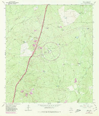
1965 Map of Orvil
USGS Topo · Published 1980About this map
The settlement of Orvil and the surrounding brushlands of Webb County are defined here by a massive industrial testing facility, the Tire Proving Ground, featuring a prominent circular track and an Observation Tower. This landscape in South Texas illustrates the transition from traditional ranching to specialized industry during the mid-20th century. The Missouri Pacific railroad serves as the primary transportation artery, cutting a straight line through the terrain alongside several Gravel Pits and a small Roadside Park.
Find a feature on this map
30 named features on this map. Tap any name to fly to it.
Don’t see what you’re looking for? This feature index may not catch every label — zoom into the map to look around manually.
Map Details
Editions of this 1965 Orvil Map
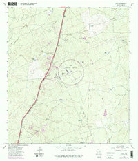
Other maps of this area

1956 · Las Tiendas
USGS Topo · 1:62,500

1956 · Islitas
USGS Topo · 1:62,500

1956 · Laredo East
USGS Topo · 1:62,500

1956 · Webb
USGS Topo · 1:62,500

1956 · Laredo
USGS Topo · 1:250,000

1965 · Laredo West
USGS Topo · 1:24,000

1965 · Orvil
USGS Topo · 1:24,000

1965 · Cuervo Creek
USGS Topo · 1:24,000

1965 · Cibolo Ranch
USGS Topo · 1:24,000

1965 · Nido Ranch
USGS Topo · 1:24,000