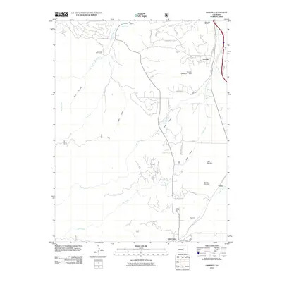
2011 Map of Larkspur
USGS Topo · Published 2011About this map
Larkspur and Palmer Lake define the eastern corridor of this Colorado Front Range landscape, where the flatlands meet the rising foothills. The drainage patterns of West Plum Creek and East Plum Creek dictate the layout of ranching properties and transit routes through the area. Local land use is characterized by a mix of residential development and traditional resource extraction, seen in the presence of the Churchill Mine and Higginson Pit. Significant terrain features like Spruce Mountain and Raspberry Butte provide prominent vertical relief against the valley floor, while isolated structures such as the Swank Cabin and the Perry Park Airport mark the diverse human footprint on the land. The map illustrates a network of canyons, including Starr Canyon and Metz Canyon, that channel water from the higher elevations toward Cantrill Reservoir and the developing communities below.
Find a feature on this map
47 named features on this map. Tap any name to fly to it.
Don’t see what you’re looking for? This feature index may not catch every label — zoom into the map to look around manually.
Map Details
Editions of this 2011 Larkspur Map
This is the sole edition of this map. No revisions or reprints were ever made.
Other maps of this area

1893 · Platte Canyon
USGS Topo · 1:125,000

1894 · Castle Rock
USGS Topo · 1:125,000

1913 · Castle Rock
USGS Topo · 1:125,000

1940 · Castle Rock
USGS Topo · 1:62,500

1945 · Castle Rock
USGS Topo · 1:62,500

1953 · Denver
USGS Topo · 1:250,000

1954 · Devils Head
USGS Topo · 1:24,000
1954 · Monument
USGS Topo · 1:24,000
1954 · Greenland
USGS Topo · 1:24,000

1954 · Mount Deception
USGS Topo · 1:24,000