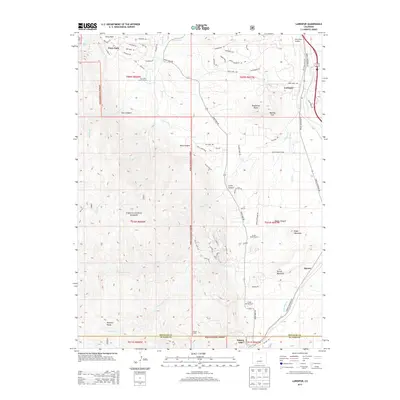
2013 Map of Larkspur
USGS Topo · Published 2013About this map
Larkspur and Perry Park anchor this region along the eastern edge of the Pike National Forest, where the high plains meet the steep elevations of the Rampart Range. The landscape is defined by its dramatic geological formations, including Raspberry Butte, Monkey Face, and Spruce Mountain. Residential expansion is evident in the layout of Green Valley Ranch and Crystal Springs Ranch, while the legacy of earlier settlement is marked by sites like Swank Cabin. The area's hydrology is dominated by the branching paths of W Plum Cr and E Plum Cr, which flow through canyons such as Metz Canyon and Starr Canyon. This geography reflects a modern transition from ranching to rural-residential living, maintained by a network of winding roads like Perry Park Rd and Spruce Mountain Rd that navigate the challenging terrain between the forest boundary and the plains.
Find a feature on this map
68 named features on this map. Tap any name to fly to it.
Don’t see what you’re looking for? This feature index may not catch every label — zoom into the map to look around manually.
Map Details
Editions of this 2013 Larkspur Map
This is the sole edition of this map. No revisions or reprints were ever made.
Other maps of this area

1893 · Platte Canyon
USGS Topo · 1:125,000

1894 · Castle Rock
USGS Topo · 1:125,000

1913 · Castle Rock
USGS Topo · 1:125,000

1940 · Castle Rock
USGS Topo · 1:62,500

1945 · Castle Rock
USGS Topo · 1:62,500

1953 · Denver
USGS Topo · 1:250,000

1954 · Devils Head
USGS Topo · 1:24,000
1954 · Monument
USGS Topo · 1:24,000
1954 · Greenland
USGS Topo · 1:24,000

1954 · Mount Deception
USGS Topo · 1:24,000