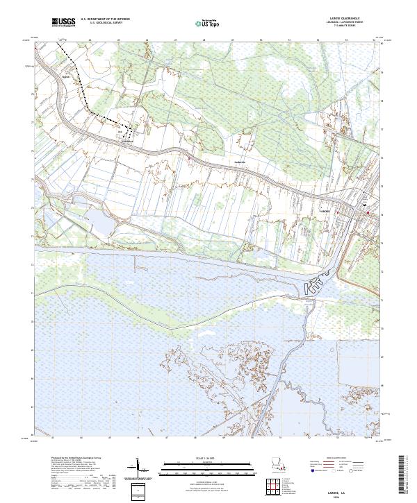
2024 Map of Larose
USGS Topo · Published 2024About this map
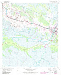
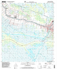
Larose serves as the focal point of this coastal Louisiana landscape, where the ribbon-like development along Bayou Lafourche meets the engineered precision of the Intracoastal Waterway. This survey illustrates the traditional settlement pattern of the region, with long, narrow land tracts extending back from the bayou toward the wetlands. The transition from established communities like Valentine and Ludevine into the surrounding marsh is marked by a complex network of drainage and transport canals, including the Forty Arpent Canal and Grand Bayou Canal. Local history is anchored by landmarks such as the Holy Rosary Cem and small settlements like Norah and Jay. The area south of Bayou Blue reveals a landscape dominated by tidal wetlands and winding watercourses, showing the delicate balance between habitation and the encroaching Gulf environment.
Find a feature on this map
75 named features on this map. Tap any name to fly to it.
Don’t see what you’re looking for? This feature index may not catch every label — zoom into the map to look around manually.
Map Details
Editions of this 2024 Larose Map
This is the sole edition of this map. No revisions or reprints were ever made.
Historical Maps of Valentine Through Time
3 maps found