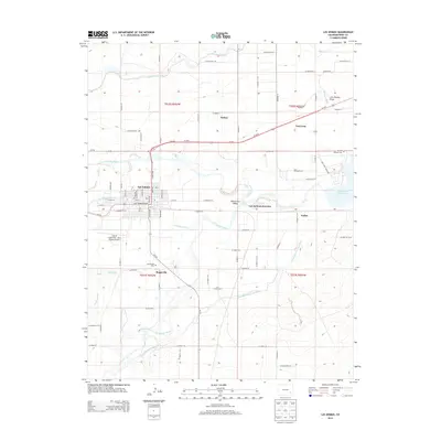
2013 Map of Las Animas
USGS Topo · Published 2013About this map
Las Animas and the historical site of Boggsville sit at the strategic confluence where the Purgatoire River joins the Arkansas River. This 2013 topographic survey illustrates the sophisticated irrigation infrastructure that sustains the Picketwire Valley, including the Fort Lyon Canal, Consolidated Ditch, and Highland Canal. To the east, the map captures the military and commemorative importance of Fort Lyon and the Ft Lyon National Cem, situated near the western edge of the John Martin Reservoir. The transport network of US-50 connects several smaller points of interest like Las Animas Junction, Melina, and Keller. The presence of the City of Las Animas - Bent County Airport and the Las Animas Cem provides significant reference points for those researching modern family records or regional aviation history in Bent County.
Find a feature on this map
62 named features on this map. Tap any name to fly to it.
Don’t see what you’re looking for? This feature index may not catch every label — zoom into the map to look around manually.
Map Details
Editions of this 2013 Las Animas Map
This is the sole edition of this map. No revisions or reprints were ever made.
Other maps of this area

1891 · Higbee
USGS Topo · 1:125,000

1891 · Las Animas
USGS Topo · 1:125,000

1893 · Higbee
USGS Topo · 1:125,000

1893 · Las Animas
USGS Topo · 1:125,000

1953 · Las Animas
USGS Topo · 1:24,000

1953 · Cornelia
USGS Topo · 1:24,000

1953 · Kreybill
USGS Topo · 1:24,000

1954 · Lamar
USGS Topo · 1:250,000

1955 · Tree Top Ranch
USGS Topo · 1:24,000

1955 · Mc Intosh Ranch
USGS Topo · 1:24,000