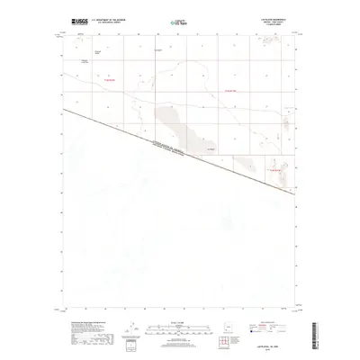
2018 Map of Las Playas
USGS Topo · Published 2018About this map
The international boundary between the United States of America and Mexico bisects this arid landscape, where the southern reaches of Yuma County meet the northern expanse of Sonora. This 2018 survey documents a remote desert environment dominated by Las Playas, a significant ephemeral dry lake bed that serves as a primary drainage point for the surrounding terrain. To the north and west, the geography transitions into the Tule Desert and the distinct volcanic geology of the Pinacate Lava Flow, which edges into the Pinacate Valley. The map records the natural drainage patterns of the region, including the intermittent flow of Papago Wash as it moves across the border. This specific survey is notable for its detail of the border line itself, showing the intersection of international sovereignty with the natural features of the Sonoran Desert.
Find a feature on this map
9 named features on this map. Tap any name to fly to it.
Don’t see what you’re looking for? This feature index may not catch every label — zoom into the map to look around manually.
Map Details
Editions of this 2018 Las Playas Map
This is the sole edition of this map. No revisions or reprints were ever made.
Other maps of this area

1953 · Ajo
USGS Topo · 1:250,000

1954 · Sonoyta
USGS Topo · 1:250,000

1957 · Ajo
USGS Topo · 1:250,000

1958 · Ajo
USGS Topo · 1:250,000

1962 · Ajo
USGS Topo · 1:250,000

1963 · Ajo
USGS Topo · 1:250,000

1963 · Lukeville
USGS Topo · 1:250,000

1965 · O'Neill Hills
USGS Topo · 1:62,500

1965 · Sierra Arida
USGS Topo · 1:62,500

1967 · Ajo
USGS Topo · 1:250,000