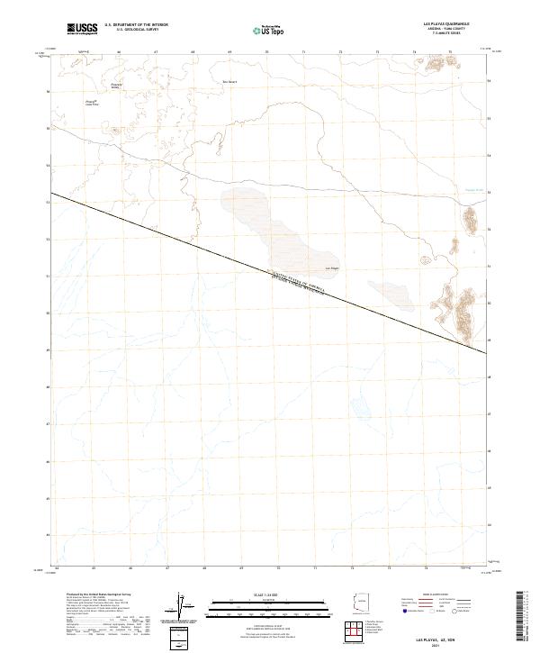
2021 Map of Las Playas
USGS Topo · Published 2021About this map
The international border between the United States of America and Mexico cuts diagonally across this remote desert landscape, marking a stark political division in an otherwise continuous environment. The terrain is defined by the vast Tule Desert and the geological signatures of the Pinacate Lava Flow, which spills into the Pinacate Valley at the northern edge of the sheet. Seasonal water patterns are evident in the presence of Las Playas, a large dry lake or basin, and Papago Wash to the east. The map provides a precise contemporary record of this borderland, showing how section lines and township boundaries like t15s r11w and t16s r11w impose a grid on the open desert flats and volcanic remnants near the border.
Find a feature on this map
9 named features on this map. Tap any name to fly to it.
Don’t see what you’re looking for? This feature index may not catch every label — zoom into the map to look around manually.
Map Details
Editions of this 2021 Las Playas Map
This is the sole edition of this map. No revisions or reprints were ever made.
Other maps of this area

1953 · Ajo
USGS Topo · 1:250,000

1954 · Sonoyta
USGS Topo · 1:250,000

1957 · Ajo
USGS Topo · 1:250,000

1958 · Ajo
USGS Topo · 1:250,000

1962 · Ajo
USGS Topo · 1:250,000

1963 · Ajo
USGS Topo · 1:250,000

1963 · Lukeville
USGS Topo · 1:250,000

1965 · O'Neill Hills
USGS Topo · 1:62,500

1965 · Sierra Arida
USGS Topo · 1:62,500

1967 · Ajo
USGS Topo · 1:250,000