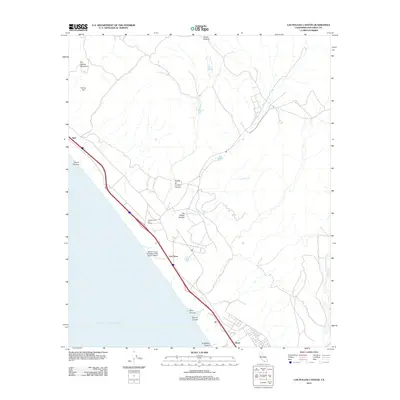
2012 Map of Las Pulgas Canyon
USGS Topo · Published 2012About this map
Asistencia de Las Flores stands as a focal point of this coastal landscape, situated within the military boundaries of Marine Corps Base Camp Pendleton. This 2012 survey illustrates the juxtaposition of historical sites with modern military infrastructure, such as the MCOLF Camp Pendleton (Red Beach) Airport. The terrain is defined by a series of significant drainages and elevations, including San Onofre Mountain and Horno Hill, which overlook the coastal corridor. Settlement patterns are concentrated along the rail and highway lines, with Agra, Las Flores, and Stuart serving as key markers. The coastal topography is deeply etched by canyons such as Piedra de Lumbre Canyon and Las Pulgas Canyon, while Pulgas Lake and the Santa Margarita River provide vital freshwater features in this arid environment.
Find a feature on this map
19 named features on this map. Tap any name to fly to it.
Don’t see what you’re looking for? This feature index may not catch every label — zoom into the map to look around manually.
Map Details
Editions of this 2012 Las Pulgas Canyon Map
This is the sole edition of this map. No revisions or reprints were ever made.
Other maps of this area

1893 · Oceanside
USGS Topo · 1:62,500

1898 · Oceanside
USGS Topo · 1:62,500

1901 · Oceanside
USGS Topo · 1:62,500

1901 · San Luis Rey
USGS Topo · 1:125,000

1902 · Capistrano
USGS Topo · 1:125,000

1904 · Southern California Sheet No. 2
USGS Topo · 1:250,000

1906 · Capistrano
USGS Topo · 1:125,000

1941 · Margarita Peak
USGS Topo · 1:62,500

1942 · Margarita Peak
USGS Topo · 1:62,500

1942 · San Juan Capistrano
USGS Topo · 1:62,500
Featured Places
- Las Flores, Marine Corps Base Camp Pendleton
- Marine Corps Base Camp Pendleton, CA
- San Diego County, CA
- United States
- California