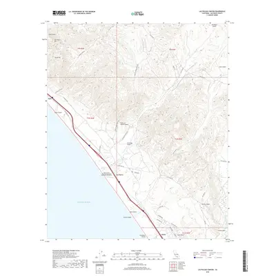
2018 Map of Las Pulgas Canyon
USGS Topo · Published 2018About this map
Las Flores and the adjacent Marine Corps Outlying Field Camp Pendleton (Red Beach) anchor this coastal survey of Northern San Diego County. The landscape is defined by the steep coastal drainages of Las Pulgas Canyon and French Canyon which cut toward the Pacific Ocean. This modern topographic study illustrates the heavy military infrastructure integrated into the natural terrain, including the training grounds at Stuart Mesa and the tidal environment of Las Flores Marsh. Traces of the region's transportation history are evident in the alignment of the Old Pacific Hwy and El Camino Real, which parallel the coastline near the small settlements of Agra and Stuart. To the east, the rugged topography rises toward San Onofre Mtn and Horno Hill, split by the Santa Margarita River as it approaches the Ysidora Basin.
Find a feature on this map
45 named features on this map. Tap any name to fly to it.
Don’t see what you’re looking for? This feature index may not catch every label — zoom into the map to look around manually.
Map Details
Editions of this 2018 Las Pulgas Canyon Map
This is the sole edition of this map. No revisions or reprints were ever made.
Other maps of this area

1893 · Oceanside
USGS Topo · 1:62,500

1898 · Oceanside
USGS Topo · 1:62,500

1901 · Oceanside
USGS Topo · 1:62,500

1901 · San Luis Rey
USGS Topo · 1:125,000

1902 · Capistrano
USGS Topo · 1:125,000

1904 · Southern California Sheet No. 2
USGS Topo · 1:250,000

1906 · Capistrano
USGS Topo · 1:125,000

1941 · Margarita Peak
USGS Topo · 1:62,500

1942 · Margarita Peak
USGS Topo · 1:62,500

1942 · San Juan Capistrano
USGS Topo · 1:62,500
Featured Places
- Las Flores, Marine Corps Base Camp Pendleton
- Marine Corps Base Camp Pendleton, CA
- San Diego County, CA
- United States
- California