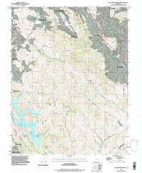
1993 Map of Las Trampas Ridge
USGS Topo · Published 1997About this map
St Marys College and the surrounding valley communities define this East Bay landscape as it transitioned into the late 20th century. The map illustrates a period of significant suburban infill within the San Ramon Valley and Moraga Valley, where residential footprints in Lafayette, Alamo, and Danville press against the undeveloped slopes of Las Trampas Ridge. This geography creates a sharp contrast between the dense street grids of Moraga and the preserved open spaces to the south and west.
Find a feature on this map
43 named features on this map. Tap any name to fly to it.
Don’t see what you’re looking for? This feature index may not catch every label — zoom into the map to look around manually.
Map Details
Editions of this 1993 Las Trampas Ridge Map
This is the sole edition of this map. No revisions or reprints were ever made.
Other maps of this area

1896 · Mt. Diablo
USGS Topo · 1:62,500

1897 · Concord
USGS Topo · 1:62,500

1898 · Mt. Diablo
USGS Topo · 1:62,500

1899 · Haywards
USGS Topo · 1:62,500

1906 · Pleasanton
USGS Topo · 1:62,500

1915 · Haywards
USGS Topo · 1:62,500

1915 · Concord
USGS Topo · 1:62,500

1941 · Pleasanton
USGS Topo · 1:62,500

1942 · Concord
USGS Topo · 1:62,500

1942 · Hayward
USGS Topo · 1:62,500