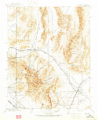
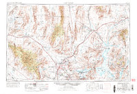
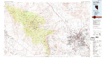
1957 Map of Las Vegas
USGS Topo · Published 1957About this map
Las Vegas and North Las Vegas anchor the central valley in this mid-century survey, surrounded by a rapidly expanding infrastructure of aviation and desert management. The landscape is defined by massive federal footprints, including the Las Vegas Bombing and Gunnery Range and the Desert Game Range, which dominate the northern and western terrain. Aviation hubs such as McCarran Field, Sky Haven Airport, and Nellis Air Force Base reflect the city's strategic role during the Cold War. To the southeast, the engineering of the Hoover Dam has filled Lake Mead, creating a massive reservoir that branches into Boulder Canyon and Iceberg Canyon. The Union Pacific Railroad serves as a vital artery, connecting outlying settlements like Arden, Bracken, and Henderson to the regional core. Along the Muddy River and Virgin River to the northeast, agricultural communities such as Logandale, Overton, and Bunkerville persist as green corridors against the arid Dry Lake Valley.
Find a feature on this map
93 named features on this map. Tap any name to fly to it.
Don’t see what you’re looking for? This feature index may not catch every label — zoom into the map to look around manually.
Map Details
Editions of this 1957 Las Vegas Map
This is the sole edition of this map. No revisions or reprints were ever made.
Historical Maps of Santa Fe Vistas Through Time
8 maps found