1959 Map of Las Vegas
USGS Topo · Published 1959About this map
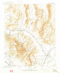
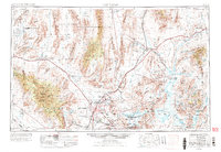
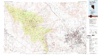
Las Vegas Valley serves as the focal point for this mid-century look at Southern Nevada, showing the city's early expansion alongside heavy industrial and military footprints. The map details the burgeoning communities of North Las Vegas and Henderson, including specialized housing developments like Victory Village and Carver Park near the massive magnesium plant. This era was defined by the intersection of federal infrastructure and the burgeoning Cold War landscape, evidenced by the Las Vegas Bombing and Gunnery Range and the nearby Proving Grounds at Yucca Flat.
Find a feature on this map
159 named features on this map. Tap any name to fly to it.
Don’t see what you’re looking for? This feature index may not catch every label — zoom into the map to look around manually.
Map Details
Editions of this 1959 Las Vegas Map
This is the sole edition of this map. No revisions or reprints were ever made.
Historical Maps of Santa Fe Vistas Through Time
8 maps found