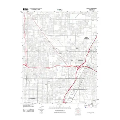
2012 Map of Las Vegas NW
USGS Topo · Published 2012About this map
Las Vegas and North Las Vegas are shown in a high state of development during this 2012 survey, with a dense grid of residential and commercial expansion reaching toward Spring Valley and Winchester. The map illustrates the region's transition from a desert oasis, suggested by historic water sources like Vegas Spring and Kyle Spring, to a major metropolitan hub. Landmarks such as the North Las Vegas Air Terminal and Cashman Field anchor the landscape, while the proliferation of neighborhood services is evident through numerous postal facilities including the Downtown Station Post Office and Federal Station Post Office. Recreation and local history are represented by the Craig Ranch Golf Course, Craig Road Speedway, and the established grounds of Woodlawn Cemetery near the eastern boundary.
Find a feature on this map
99 named features on this map. Tap any name to fly to it.
Don’t see what you’re looking for? This feature index may not catch every label — zoom into the map to look around manually.
Map Details
Editions of this 2012 Las Vegas NW Map
This is the sole edition of this map. No revisions or reprints were ever made.
Other maps of this area

1907 · Las Vegas
USGS Topo · 1:250,000

1908 · Las Vegas
USGS Topo · 1:250,000

1952 · Corn Creek Springs
USGS Topo · 1:62,500

1952 · Gass Peak
USGS Topo · 1:62,500

1952 · Blue Diamond
USGS Topo · 1:62,500

1952 · Las Vegas
USGS Topo · 1:62,500

1954 · Las Vegas
USGS Topo · 1:250,000

1957 · Las Vegas
USGS Topo · 1:250,000

1959 · Las Vegas
USGS Topo · 1:250,000

1962 · Las Vegas
USGS Topo · 1:250,000