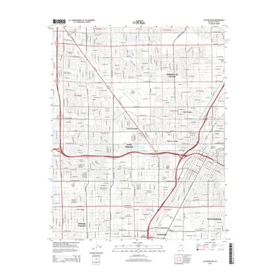
2015 Map of Las Vegas NW
USGS Topo · Published 2015About this map
The dense urban grid of Las Vegas and North Las Vegas dominates this 2015 survey, illustrating the rapid expansion into the Las Vegas Valley. This modern landscape is built around legacy landmarks like the North Las Vegas Airport and Cashman Field, while pockets of the natural desert environment persist at Vegas Spring and Twin Lakes. The map traces the intricate network of arterial roads, from W Sahara Ave in the south to the northern reaches of W Craig Rd, delineating distinct neighborhoods such as Bonanza Village, Vegas Heights, and Eastland Heights. Educational and cultural institutions like the Coll of Southern Nevada and the Acad of Healing Arts are integrated within the residential sprawl. To the southeast, the map captures the transition into Winchester and Paradise, reflecting the jurisdictional complexity of the southern Nevada metropolitan area.
Find a feature on this map
50 named features on this map. Tap any name to fly to it.
Don’t see what you’re looking for? This feature index may not catch every label — zoom into the map to look around manually.
Map Details
Editions of this 2015 Las Vegas NW Map
This is the sole edition of this map. No revisions or reprints were ever made.
Other maps of this area

1907 · Las Vegas
USGS Topo · 1:250,000

1908 · Las Vegas
USGS Topo · 1:250,000

1952 · Corn Creek Springs
USGS Topo · 1:62,500

1952 · Gass Peak
USGS Topo · 1:62,500

1952 · Blue Diamond
USGS Topo · 1:62,500

1952 · Las Vegas
USGS Topo · 1:62,500

1954 · Las Vegas
USGS Topo · 1:250,000

1957 · Las Vegas
USGS Topo · 1:250,000

1959 · Las Vegas
USGS Topo · 1:250,000

1962 · Las Vegas
USGS Topo · 1:250,000