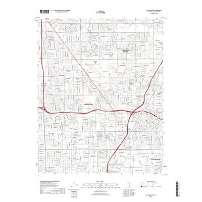
2018 Map of Las Vegas NW
USGS Topo · Published 2018About this map
Las Vegas and North Las Vegas dominate this 2018 topographic landscape, revealing the dense urban development of the Las Vegas Valley within the Mojave Desert. The map captures the intricate street grid of the city's northwestern reaches, bisected by the Union Pacific Railroad corridor. Historically significant water sources, including Vegas Spring, Kyle Spring, and the Twin Lakes, appear amidst the modern infrastructure. Educational and community anchors like the College of Southern Nevada - Charleston Campus and Kaplan College Las Vegas Campus are clearly marked, alongside the North Las Vegas Airport and the recreational grounds of Cashman Field. This map provides a look at the transition from the city's residential neighborhoods to the unincorporated community of Winchester and the historic Woodlawn Cem.
Find a feature on this map
39 named features on this map. Tap any name to fly to it.
Don’t see what you’re looking for? This feature index may not catch every label — zoom into the map to look around manually.
Map Details
Editions of this 2018 Las Vegas NW Map
This is the sole edition of this map. No revisions or reprints were ever made.
Other maps of this area

1907 · Las Vegas
USGS Topo · 1:250,000

1908 · Las Vegas
USGS Topo · 1:250,000

1952 · Corn Creek Springs
USGS Topo · 1:62,500

1952 · Gass Peak
USGS Topo · 1:62,500

1952 · Blue Diamond
USGS Topo · 1:62,500

1952 · Las Vegas
USGS Topo · 1:62,500

1954 · Las Vegas
USGS Topo · 1:250,000

1957 · Las Vegas
USGS Topo · 1:250,000

1959 · Las Vegas
USGS Topo · 1:250,000

1962 · Las Vegas
USGS Topo · 1:250,000