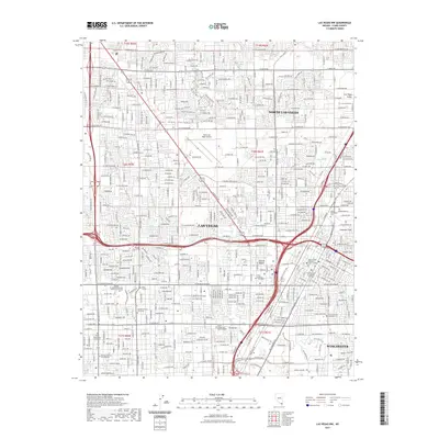
2021 Map of Las Vegas NW
USGS Topo · Published 2021About this map
Las Vegas and North Las Vegas sprawl across the Las Vegas Valley in this detailed look at the metropolitan core during the early 2020s. The landscape is a dense grid of residential streets and commercial corridors, punctuated by landmarks like the North Las Vegas Airport and the expansive Cashman Field complex. Natural water features, though often obscured by urban development, are still noted through Vegas Spring, Kyle Spring, and the Twin Lakes area, reflecting the foundational water sources that allowed this portion of the Mojave Desert to flourish. To the southeast, the district of Winchester appears alongside major civic infrastructure, including the Clark County Regional Justice Center and the Supreme Court of Nevada Las Vegas. For genealogists and local historians, the map precisely locates several major burial sites, including Palm Downtown Cem and Woodlawn Cem, alongside numerous educational institutions like the College of Southern Nevada - Charleston Campus.
Find a feature on this map
60 named features on this map. Tap any name to fly to it.
Don’t see what you’re looking for? This feature index may not catch every label — zoom into the map to look around manually.
Map Details
Editions of this 2021 Las Vegas NW Map
This is the sole edition of this map. No revisions or reprints were ever made.
Other maps of this area

1907 · Las Vegas
USGS Topo · 1:250,000

1908 · Las Vegas
USGS Topo · 1:250,000

1952 · Corn Creek Springs
USGS Topo · 1:62,500

1952 · Gass Peak
USGS Topo · 1:62,500

1952 · Blue Diamond
USGS Topo · 1:62,500

1952 · Las Vegas
USGS Topo · 1:62,500

1954 · Las Vegas
USGS Topo · 1:250,000

1957 · Las Vegas
USGS Topo · 1:250,000

1959 · Las Vegas
USGS Topo · 1:250,000

1962 · Las Vegas
USGS Topo · 1:250,000