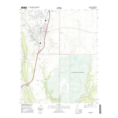
2017 Map of Las Vegas
USGS Topo · Published 2017About this map
Las Vegas serves as the focal point of this northern New Mexico landscape, where the urban grid meets the high plains and canyons. The presence of New Mexico Highlands Univ and a dense concentration of burial sites, including Mount Calvary Cem and the Masonic Cem, reflects the town's role as a significant regional center. To the south, the settlement of Romeroville sits near the Gallinas River, while the east is dominated by the Las Vegas National Wildlife Refuge, featuring McAllister Lake and Bentley Lake. The map illustrates a transition from the structured streets of the city to the water-managed lands of the refuge and the rugged breaks of Box Canyon and Abeyta Canyon. Distinctive landforms like The Creston and Puerto del Norte frame the western edge, marking the gateway between the plains and the mountains.
Find a feature on this map
78 named features on this map. Tap any name to fly to it.
Don’t see what you’re looking for? This feature index may not catch every label — zoom into the map to look around manually.
Map Details
Editions of this 2017 Las Vegas Map
This is the sole edition of this map. No revisions or reprints were ever made.
Other maps of this area

1889 · Las Vegas
USGS Topo · 1:125,000

1890 · Bernal
USGS Topo · 1:125,000

1891 · Bernal
USGS Topo · 1:125,000

1891 · Las Vegas
USGS Topo · 1:125,000

1893 · Las Vegas
USGS Topo · 1:125,000

1894 · Bernal
USGS Topo · 1:125,000

1954 · Santa Fe
USGS Topo · 1:250,000

1958 · Santa Fe
USGS Topo · 1:250,000

1960 · Villanueva
USGS Topo · 1:62,500

1960 · Apache Springs
USGS Topo · 1:62,500