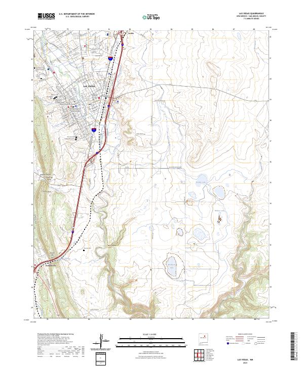
2023 Map of Las Vegas
USGS Topo · Published 2023About this map
The Las Vegas city center and its eastern pastoral landscape define this contemporary study of San Miguel County. The urban core is anchored by institutional landmarks including New Mexico Highlands University and the New Mexico State Hospital, while the surrounding geography is characterized by numerous historic burial grounds such as Montefiore Cem, Masonic Cem, and the Independent Order of Odd Fellows Cem. These sites, along with the Nuestra Senora de Dolores Catholic Church, provide a dense record of the community’s social and religious heritage.
Find a feature on this map
121 named features on this map. Tap any name to fly to it.
Don’t see what you’re looking for? This feature index may not catch every label — zoom into the map to look around manually.
Map Details
Editions of this 2023 Las Vegas Map
This is the sole edition of this map. No revisions or reprints were ever made.
Other maps of this area

1889 · Las Vegas
USGS Topo · 1:125,000

1890 · Bernal
USGS Topo · 1:125,000

1891 · Bernal
USGS Topo · 1:125,000

1891 · Las Vegas
USGS Topo · 1:125,000

1893 · Las Vegas
USGS Topo · 1:125,000

1894 · Bernal
USGS Topo · 1:125,000

1954 · Santa Fe
USGS Topo · 1:250,000

1958 · Santa Fe
USGS Topo · 1:250,000

1960 · Villanueva
USGS Topo · 1:62,500

1960 · Apache Springs
USGS Topo · 1:62,500