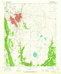
1963 Map of Las Vegas
USGS Topo · Published 1965About this map
Las Vegas City and Las Vegas Town form a dual settlement center along the Gallinas River in the early 1960s. The landscape is a hub of education and civic infrastructure, anchored by Highlands University, the State Hospital, and multiple schools such as Robertson High Sch and West Las Vegas High Sch. The town's historical foundations are evident in the path of the Santa Fe Trail and the heavy rail presence of the Atchison Topeka and Santa Fe railroad.
Find a feature on this map
48 named features on this map. Tap any name to fly to it.
Don’t see what you’re looking for? This feature index may not catch every label — zoom into the map to look around manually.
Map Details
Editions of this 1963 Las Vegas Map
This is the sole edition of this map. No revisions or reprints were ever made.
Other maps of this area

1889 · Las Vegas
USGS Topo · 1:125,000

1890 · Bernal
USGS Topo · 1:125,000

1891 · Bernal
USGS Topo · 1:125,000

1891 · Las Vegas
USGS Topo · 1:125,000

1893 · Las Vegas
USGS Topo · 1:125,000

1894 · Bernal
USGS Topo · 1:125,000

1954 · Santa Fe
USGS Topo · 1:250,000

1958 · Santa Fe
USGS Topo · 1:250,000

1960 · Villanueva
USGS Topo · 1:62,500

1960 · Apache Springs
USGS Topo · 1:62,500