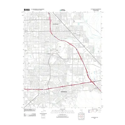
2012 Map of Las Vegas SE
USGS Topo · Published 2012About this map
Whitney Mesa stands as a prominent geologic feature within this complex suburban landscape at the edge of the Mojave Desert. The map traces the dense development between Las Vegas and Henderson, illustrating how residential grids and major highway corridors have integrated with the natural drainages of the Las Vegas Wash and Duck Creek. Local landmarks like the McCarran International Airport and the smaller Voc Tech Airport define the area's transportation infrastructure, while older desert features such as Grapevine Springs, Mesquite Spring, and Cow Spring offer clues to the region's hydrologic history before extensive urbanization. Neighborhoods like Paradise Valley, Whitney, and Royson are shown in high detail, punctuated by essential community hubs including the Pittman Station Post Office and East Las Vegas Branch Post Office.
Find a feature on this map
122 named features on this map. Tap any name to fly to it.
Don’t see what you’re looking for? This feature index may not catch every label — zoom into the map to look around manually.
Map Details
Editions of this 2012 Las Vegas SE Map
This is the sole edition of this map. No revisions or reprints were ever made.
Other maps of this area

1886 · Camp Mohave
USGS Topo · 1:250,000

1886 · Saint Thomas
USGS Topo · 1:250,000

1892 · Camp Mohave
USGS Topo · 1:250,000

1893 · Saint Thomas
USGS Topo · 1:250,000

1907 · Las Vegas
USGS Topo · 1:250,000

1908 · Las Vegas
USGS Topo · 1:250,000

1910 · Ivanpah
USGS Topo · 1:250,000

1912 · Ivanpah
USGS Topo · 1:250,000

1926 · Nelson
USGS Topo · 1:96,000

1926 · Boulder Canyon
USGS Topo · 1:96,000