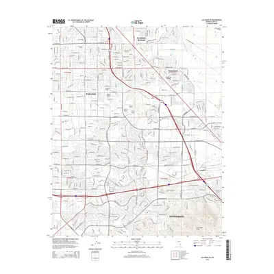
2015 Map of Las Vegas SE
USGS Topo · Published 2015About this map
Sunrise Manor and Whitney anchor this suburban and industrial corridor in the southeastern Las Vegas Valley. The landscape transitions from the dense residential grids of Paradise and East Las Vegas toward the rising slopes of the McCullough Range and the Frenchman Range. Educational and transportation hubs are prominent, including the Univ of Southern Nevada, Las Vegas Coll, and the Voc Tech Airport.
Find a feature on this map
105 named features on this map. Tap any name to fly to it.
Don’t see what you’re looking for? This feature index may not catch every label — zoom into the map to look around manually.
Map Details
Editions of this 2015 Las Vegas SE Map
This is the sole edition of this map. No revisions or reprints were ever made.
Other maps of this area

1886 · Camp Mohave
USGS Topo · 1:250,000

1886 · Saint Thomas
USGS Topo · 1:250,000

1892 · Camp Mohave
USGS Topo · 1:250,000

1893 · Saint Thomas
USGS Topo · 1:250,000

1907 · Las Vegas
USGS Topo · 1:250,000

1908 · Las Vegas
USGS Topo · 1:250,000

1910 · Ivanpah
USGS Topo · 1:250,000

1912 · Ivanpah
USGS Topo · 1:250,000

1926 · Nelson
USGS Topo · 1:96,000

1926 · Boulder Canyon
USGS Topo · 1:96,000