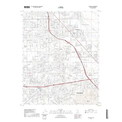
2018 Map of Las Vegas SE
USGS Topo · Published 2018About this map
Whitney and the southeastern reaches of the Las Vegas Valley are defined by a dense residential and academic landscape at the edge of the Mojave Desert. This 2018 survey documents the significant educational infrastructure of the region, featuring campuses such as the DeVry Univ Henderson Campus, Everest College, and The Art Institute of Las Vegas. The topography transitions from the suburban sprawl of Paradise Valley and Henderson toward the prominent landforms of Whitney Mesa and the northern slopes of the McCullough Range. Transport corridors like the Union Pacific railroad and major thoroughfares including Wigwam Pkwy and Paseo Verde Pkwy facilitate the area's modern connectivity. Natural features like the Las Vegas Wash and Duck Cr provide a stark contrast to the heavily gridded street network, while local springs like Cold Spring and Mesquite Spring offer a reminder of the valley's arid hydrology.
Find a feature on this map
78 named features on this map. Tap any name to fly to it.
Don’t see what you’re looking for? This feature index may not catch every label — zoom into the map to look around manually.
Map Details
Editions of this 2018 Las Vegas SE Map
This is the sole edition of this map. No revisions or reprints were ever made.
Other maps of this area

1886 · Camp Mohave
USGS Topo · 1:250,000

1886 · Saint Thomas
USGS Topo · 1:250,000

1892 · Camp Mohave
USGS Topo · 1:250,000

1893 · Saint Thomas
USGS Topo · 1:250,000

1907 · Las Vegas
USGS Topo · 1:250,000

1908 · Las Vegas
USGS Topo · 1:250,000

1910 · Ivanpah
USGS Topo · 1:250,000

1912 · Ivanpah
USGS Topo · 1:250,000

1926 · Nelson
USGS Topo · 1:96,000

1926 · Boulder Canyon
USGS Topo · 1:96,000