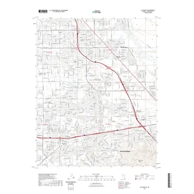
2021 Map of Las Vegas SE
USGS Topo · Published 2021About this map
Henderson and the Las Vegas Valley anchor this 2021 survey, showing the complex suburban and educational geography of the modern metropolitan area. The landscape is defined by its transition from the built environment of Paradise Valley and Whitney to the natural elevation of Whitney Mesa and the McCullough Range. This map serves as an exceptional record of educational infrastructure, featuring numerous institutions such as Roseman University, Touro University Nevada, and the University of Phoenix. Significant commemorative spaces including Palm Eastern Cem and King David Memorial Chapel and Cem sit alongside major transit hubs like Harry Reid International Airport. Water features such as Duck Creek and Grapevine Springs provide a contrast to the surrounding Mojave Desert, highlighting the persistent role of hydrology in this arid region.
Find a feature on this map
45 named features on this map. Tap any name to fly to it.
Don’t see what you’re looking for? This feature index may not catch every label — zoom into the map to look around manually.
Map Details
Editions of this 2021 Las Vegas SE Map
This is the sole edition of this map. No revisions or reprints were ever made.
Other maps of this area

1886 · Camp Mohave
USGS Topo · 1:250,000

1886 · Saint Thomas
USGS Topo · 1:250,000

1892 · Camp Mohave
USGS Topo · 1:250,000

1893 · Saint Thomas
USGS Topo · 1:250,000

1907 · Las Vegas
USGS Topo · 1:250,000

1908 · Las Vegas
USGS Topo · 1:250,000

1910 · Ivanpah
USGS Topo · 1:250,000

1912 · Ivanpah
USGS Topo · 1:250,000

1926 · Nelson
USGS Topo · 1:96,000

1926 · Boulder Canyon
USGS Topo · 1:96,000