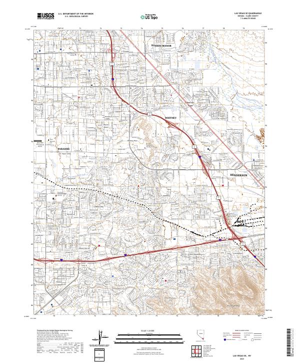
2023 Map of Las Vegas SE
USGS Topo · Published 2023About this map
Sunrise Manor and Whitney anchor the residential and commercial expanse of the southeastern Las Vegas Valley in the early 2020s. This survey illustrates the dense suburbanization reaching toward the northern slopes of the McCullough Range and the edge of the Mojave Desert. The map reveals a high concentration of educational and medical institutions, including Roseman University in Henderson Nevada, Touro University Nevada, and several campuses of the University of Phoenix Henderson Learning Center. The landscape is a mix of Master-Planned communities and rugged terrain, where Duck Creek and the Las Vegas Wash carry runoff through the developed grid. Significant memorial sites like Palm Eastern Cem and the King David Memorial Chapel and Cem provide important reference points for local history and genealogy.
Find a feature on this map
42 named features on this map. Tap any name to fly to it.
Don’t see what you’re looking for? This feature index may not catch every label — zoom into the map to look around manually.
Map Details
Editions of this 2023 Las Vegas SE Map
This is the sole edition of this map. No revisions or reprints were ever made.
Other maps of this area

1886 · Camp Mohave
USGS Topo · 1:250,000

1886 · Saint Thomas
USGS Topo · 1:250,000

1892 · Camp Mohave
USGS Topo · 1:250,000

1893 · Saint Thomas
USGS Topo · 1:250,000

1907 · Las Vegas
USGS Topo · 1:250,000

1908 · Las Vegas
USGS Topo · 1:250,000

1910 · Ivanpah
USGS Topo · 1:250,000

1912 · Ivanpah
USGS Topo · 1:250,000

1926 · Nelson
USGS Topo · 1:96,000

1926 · Boulder Canyon
USGS Topo · 1:96,000