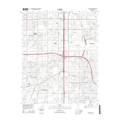
2014 Map of Las Vegas SW
USGS Topo · Published 2014About this map
Enterprise and the surrounding southwestern valley of Clark County appear in 2014 as a landscape defined by rapid suburban expansion and transportation corridors. The map records the urban density encroaching on the Mojave Desert, where residential developments such as Mountain's Edge and Spring Valley fill the grid between arterial roads like Blue Diamond Rd and W Tropicana Ave. Significant institutional footprints are visible, including the Univ of Nevada-Las Vegas and the expansive grounds of Mc Carran International Airport. Historic nodes like Arden and Bracken anchor the survey, while natural drainage features such as Tropicana Wash and Duck Creek are woven into the modern street layout. This survey captures a specific moment of transition as the Las Vegas metropolitan area integrates its older railroad roots, exemplified by the Union Pacific Railroad, with massive 21st-century residential growth.
Find a feature on this map
35 named features on this map. Tap any name to fly to it.
Don’t see what you’re looking for? This feature index may not catch every label — zoom into the map to look around manually.
Map Details
Editions of this 2014 Las Vegas SW Map
This is the sole edition of this map. No revisions or reprints were ever made.
Other maps of this area

1907 · Las Vegas
USGS Topo · 1:250,000

1908 · Las Vegas
USGS Topo · 1:250,000

1910 · Ivanpah
USGS Topo · 1:250,000

1912 · Ivanpah
USGS Topo · 1:250,000

1942 · Ivanpah
USGS Topo · 1:250,000

1947 · Kingman
USGS Topo · 1:250,000

1948 · Kingman
USGS Topo · 1:250,000

1952 · Blue Diamond
USGS Topo · 1:62,500

1952 · Las Vegas
USGS Topo · 1:62,500

1954 · Las Vegas
USGS Topo · 1:250,000