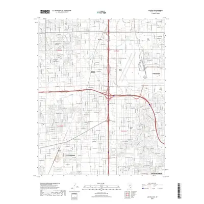
2018 Map of Las Vegas SW
USGS Topo · Published 2018About this map
Enterprise and the southern reaches of the Las Vegas Valley are shown here during a period of significant urban expansion. The landscape is defined by a dense grid of residential and commercial development, stretching from the Univ of Nevada Las Vegas campus in the north toward the growing community of Henderson in the southeast. This 2018 survey reveals the intricate road network of the Mojave Desert floor, where named thoroughfares like W Flamingo Rd and W Sunset Rd cross the basin.
Find a feature on this map
46 named features on this map. Tap any name to fly to it.
Don’t see what you’re looking for? This feature index may not catch every label — zoom into the map to look around manually.
Map Details
Editions of this 2018 Las Vegas SW Map
This is the sole edition of this map. No revisions or reprints were ever made.
Other maps of this area

1907 · Las Vegas
USGS Topo · 1:250,000

1908 · Las Vegas
USGS Topo · 1:250,000

1910 · Ivanpah
USGS Topo · 1:250,000

1912 · Ivanpah
USGS Topo · 1:250,000

1942 · Ivanpah
USGS Topo · 1:250,000

1947 · Kingman
USGS Topo · 1:250,000

1948 · Kingman
USGS Topo · 1:250,000

1952 · Blue Diamond
USGS Topo · 1:62,500

1952 · Las Vegas
USGS Topo · 1:62,500

1954 · Las Vegas
USGS Topo · 1:250,000