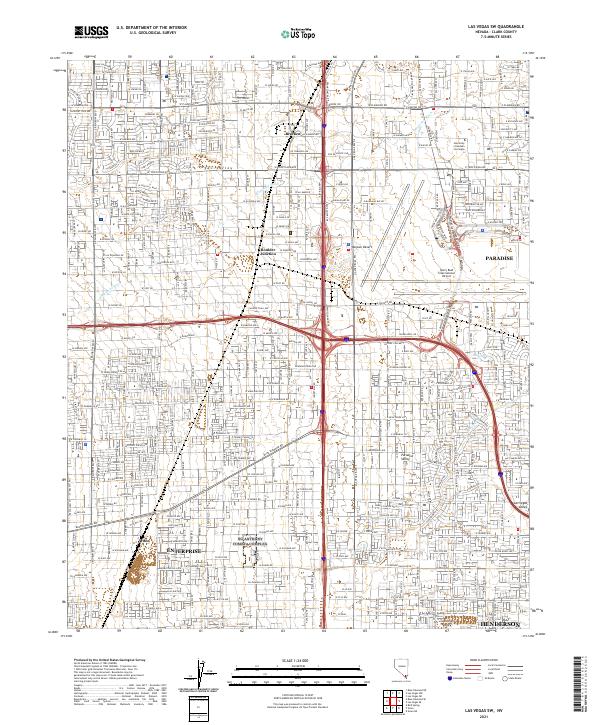
2021 Map of Las Vegas SW
USGS Topo · Published 2021About this map
The southern Las Vegas Valley is defined by rapid urban development and a complex grid of residential and commercial corridors in this 2021 study. Centered near Enterprise and Paradise, the landscape shows the intense infrastructure supporting the Mojave Desert's most famous metropolis. Major landmarks including the University of Nevada Las Vegas and the sprawling grounds of the Harry Reid International Airport occupy the northeastern quadrant, while historic railroad and settlement points like Arden, Bracken, and Boulder Junction are now integrated into the continuous suburban fabric. Natural drainage features like Tropicana Wash and Duck Creek remain visible as they thread through the developed neighborhoods. The map provides a precise look at the road network extending toward Henderson, illustrating how modern Clark County manages its water and transportation within the arid terrain of Paradise Valley.
Find a feature on this map
90 named features on this map. Tap any name to fly to it.
Don’t see what you’re looking for? This feature index may not catch every label — zoom into the map to look around manually.
Map Details
Editions of this 2021 Las Vegas SW Map
This is the sole edition of this map. No revisions or reprints were ever made.
Other maps of this area

1907 · Las Vegas
USGS Topo · 1:250,000

1908 · Las Vegas
USGS Topo · 1:250,000

1910 · Ivanpah
USGS Topo · 1:250,000

1912 · Ivanpah
USGS Topo · 1:250,000

1942 · Ivanpah
USGS Topo · 1:250,000

1947 · Kingman
USGS Topo · 1:250,000

1948 · Kingman
USGS Topo · 1:250,000

1952 · Blue Diamond
USGS Topo · 1:62,500

1952 · Las Vegas
USGS Topo · 1:62,500

1954 · Las Vegas
USGS Topo · 1:250,000