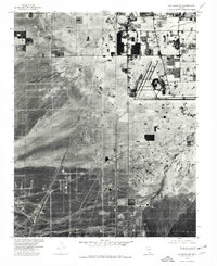
1973 Map of Las Vegas SW
USGS Topo · Published 1977About this map
Union Pacific tracks cut a stark diagonal through the desert southwest of the Las Vegas valley, marking a landscape in the early stages of massive suburban expansion. Captured in 1973 via orthophotoimagery, this sheet reveals the sparse industrial and transit footprint of Arden against a backdrop of undeveloped alluvial fans. Near the northern edge, the residential grid begins to push southward, meeting the drainage of Flamingo Wash. The presence of Mc Carran Field at the eastern margin highlights the infrastructure required for the region's burgeoning growth. Long desert stretches along Tropicana and the rail line provide a precise look at the valley's fringe before it was fully integrated into the modern metropolitan sprawl, showing the raw desert floor still dominant over the human built environment.
Find a feature on this map
5 named features on this map. Tap any name to fly to it.
Don’t see what you’re looking for? This feature index may not catch every label — zoom into the map to look around manually.
Map Details
Editions of this 1973 Las Vegas SW Map
This is the sole edition of this map. No revisions or reprints were ever made.
Other maps of this area

1907 · Las Vegas
USGS Topo · 1:250,000

1908 · Las Vegas
USGS Topo · 1:250,000

1910 · Ivanpah
USGS Topo · 1:250,000

1912 · Ivanpah
USGS Topo · 1:250,000

1942 · Ivanpah
USGS Topo · 1:250,000

1947 · Kingman
USGS Topo · 1:250,000

1948 · Kingman
USGS Topo · 1:250,000

1952 · Blue Diamond
USGS Topo · 1:62,500

1952 · Las Vegas
USGS Topo · 1:62,500

1954 · Las Vegas
USGS Topo · 1:250,000