
1956 Map of Latham
USGS Topo · Published 1958About this map
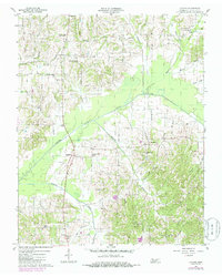
The North Fork Obion River meanders through this portion of Weakley County, defining a wide floodplain that separates the northern and southern agricultural uplands. In the mid-1950s, the rural character of this Tennessee landscape is evident through its dense network of community anchors, particularly its numerous country churches such as New Hope Ch, Concord Ch, and Pisgah Ch. The small village of Latham serves as a local hub, while smaller clusters like Brundige and Austin Springs mark the intersections of the era's light-duty road system.
Find a feature on this map
45 named features on this map. Tap any name to fly to it.
Don’t see what you’re looking for? This feature index may not catch every label — zoom into the map to look around manually.
Map Details
Editions of this 1956 Latham Map
2 editions found
Other maps of this area

1950 · Martin
USGS Topo · 1:24,000

1952 · Dresden
USGS Topo · 1:24,000

1952 · Cuba
USGS Topo · 1:24,000

1952 · Water Valley
USGS Topo · 1:24,000

1952 · Mayfield
USGS Topo · 1:62,500

1952 · Water Valley
USGS Topo · 1:62,500
1952 · Lynnville
USGS Topo · 1:24,000

1956 · Mc Connell
USGS Topo · 1:24,000
1956 · Palmersville
USGS Topo · 1:24,000

1956 · Dyersburg
USGS Topo · 1:250,000