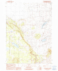
1990 Map of Lauer Reservoir
USGS Topo · Published 1990About this map
Lauer Reservoir dominates this high-altitude California landscape, where water management and ranching infrastructure define the terrain. Situated within the Modoc National Forest, the map records a network of drainages including Davis Creek, Linnville Creek, and Franklin Creek that feed into larger catchments or eventually join the North Fork Pit River. The presence of the Davis Creek Orchards Reservoir alongside various wells and mud flats suggests an environment intensely focused on hydraulic control for agricultural or livestock use. This 1990 provisional update, based on aerial photography dating back to the late 1940s, provides a technical view of the region's topographical transition from the flat expanse of Mud to the prominent rise of Round Mountain. Long-established natural features like Russell Slough are shown alongside more modern water-control points, tracing the evolution of land use in this part of Modoc County.
Find a feature on this map
12 named features on this map. Tap any name to fly to it.
Don’t see what you’re looking for? This feature index may not catch every label — zoom into the map to look around manually.
Map Details
Editions of this 1990 Lauer Reservoir Map
This is the sole edition of this map. No revisions or reprints were ever made.
Other maps of this area

1886 · Alturas
USGS Topo · 1:250,000

1892 · Alturas
USGS Topo · 1:250,000

1954 · Alturas
USGS Topo · 1:250,000

1958 · Alturas
USGS Topo · 1:250,000

1962 · Alturas
USGS Topo · 1:250,000

1962 · Davis Creek
USGS Topo · 1:62,500

1962 · Big Sage Reservoir
USGS Topo · 1:62,500

1962 · Willow Ranch
USGS Topo · 1:62,500

1962 · South Mountain
USGS Topo · 1:62,500

1965 · Alturas
USGS Topo · 1:250,000