
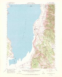
1962 Map of Willow Ranch
USGS Topo · Published 1964About this map
Goose Lake dominates this high-altitude landscape along the border of California and Oregon, its waters sitting at an elevation of 4701 feet. The eastern shore serves as a vital corridor for both the Southern Pacific railroad and the Pacific Highway, which connect the lakeside communities. The town of Willow Ranch is a focal point of local industry and life, featuring a Sawmill and the Willow Ranch Cemetery. Higher in the Warner Mountains to the east, the map reveals the complex history of western expansion and land use, marked by the Site of Fandango Pass Massacre along the Fandango Pass Road. This rugged interior contains numerous springs like Milk Spring and Gaston Spring, alongside infrastructure for the Fremont and Modoc National Forests, including a Ranger Station, Fire Lookout, and the US Forest Service Planting Camp.
Find a feature on this map
61 named features on this map. Tap any name to fly to it.
Don’t see what you’re looking for? This feature index may not catch every label — zoom into the map to look around manually.
Map Details
Editions of this 1962 Willow Ranch Map
2 editions found
Other maps of this area

1886 · Alturas
USGS Topo · 1:250,000

1892 · Alturas
USGS Topo · 1:250,000

1954 · Alturas
USGS Topo · 1:250,000

1955 · Klamath Falls
USGS Topo · 1:250,000

1958 · Alturas
USGS Topo · 1:250,000

1958 · Klamath Falls
USGS Topo · 1:250,000

1962 · Alturas
USGS Topo · 1:250,000

1962 · Davis Creek
USGS Topo · 1:62,500

1962 · Big Sage Reservoir
USGS Topo · 1:62,500

1962 · South Mountain
USGS Topo · 1:62,500