
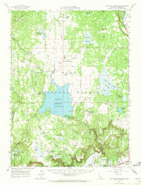
1962 Map of Big Sage Reservoir
USGS Topo · Published 1964About this map
Big Sage Reservoir dominates this high-plateau landscape within the Modoc National Forest, serving as a central hub for water management in the early 1960s. The presence of the Gaging Station Big Sage Dam and numerous peripheral catchments like the Dorris Brothers Reservoir and Raker and Thomas Reservoirs reflects a sophisticated network of upland water storage. To the south, the Devils Garden Airport and the XL Ranch Indian Res provide clear markers of land use and community presence near the northern edge of Alturas. For genealogists and local historians, family-named landmarks like Ingalls Swamp Ranch and springs such as Kelly Spring and Emigrant Spring offer tangible points for tracing early ranching and migration routes through the Modoc territory. The map also records the technical infrastructure of the era, from the Radio Station KCNO to the remote lookout points on Timbered Mountain and North Mountain.
Find a feature on this map
60 named features on this map. Tap any name to fly to it.
Don’t see what you’re looking for? This feature index may not catch every label — zoom into the map to look around manually.
Map Details
Editions of this 1962 Big Sage Reservoir Map
2 editions found
Other maps of this area

1886 · Alturas
USGS Topo · 1:250,000

1892 · Alturas
USGS Topo · 1:250,000

1954 · Alturas
USGS Topo · 1:250,000

1958 · Alturas
USGS Topo · 1:250,000

1961 · Canby
USGS Topo · 1:62,500

1961 · Alturas
USGS Topo · 1:62,500

1962 · Alturas
USGS Topo · 1:250,000

1962 · Davis Creek
USGS Topo · 1:62,500

1962 · Willow Ranch
USGS Topo · 1:62,500

1962 · Steele Swamp
USGS Topo · 1:62,500