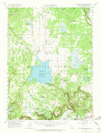
1962 Map of Big Sage Reservoir
USGS Topo · Published 1972About this map
Big Sage Reservoir dominates this high-plateau landscape in northern California, where water management is the primary driver of development. The area is defined by an extensive network of human-made water storage, including Dorris Brothers Reservoir, Raker and Thomas Reservoirs, and Kelley Reservoir. These sites, along with the Gaging Station Big Sage Dam, reveal the intricate hydrology of the Modoc National Forest during the early 1960s.
Find a feature on this map
53 named features on this map. Tap any name to fly to it.
Don’t see what you’re looking for? This feature index may not catch every label — zoom into the map to look around manually.
Map Details
Editions of this 1962 Big Sage Reservoir Map
2 editions found
Other maps of this area

1886 · Alturas
USGS Topo · 1:250,000

1892 · Alturas
USGS Topo · 1:250,000

1954 · Alturas
USGS Topo · 1:250,000

1958 · Alturas
USGS Topo · 1:250,000

1961 · Canby
USGS Topo · 1:62,500

1961 · Alturas
USGS Topo · 1:62,500

1962 · Alturas
USGS Topo · 1:250,000

1962 · Davis Creek
USGS Topo · 1:62,500

1962 · Big Sage Reservoir
USGS Topo · 1:62,500

1962 · Willow Ranch
USGS Topo · 1:62,500