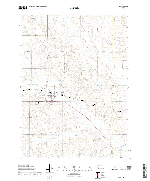
2021 Map of Laurel
USGS Topo · Published 2021About this map
The agricultural town of Laurel serves as the focal point of this northeast Nebraska survey, which details a landscape defined by an extensive network of drainage channels and small tributaries. Water management is a visible priority here, evidenced by the Logan Cr Dredge and the presence of the Old Channel Logan Creek, indicating historical alterations to the local hydrology to support the surrounding farmland. The town grid is clearly delineated, featuring local landmarks such as Laurel Cem on the western edge and Laurel Municipal Airport to the northeast.
Find a feature on this map
41 named features on this map. Tap any name to fly to it.
Don’t see what you’re looking for? This feature index may not catch every label — zoom into the map to look around manually.
Map Details
Editions of this 2021 Laurel Map
This is the sole edition of this map. No revisions or reprints were ever made.
Other maps of this area

1898 · Elk Point
USGS Topo · 1:125,000

1901 · Elk Point
USGS Topo · 1:125,000

1907 · Elk Point
USGS Topo · 1:125,000

1955 · Sioux City
USGS Topo · 1:250,000

1958 · Sioux City
USGS Topo · 1:250,000

1959 · Sioux City
USGS Topo · 1:250,000

1964 · Martinsburg SW
USGS Topo · 1:24,000

1967 · Wakefield SW
USGS Topo · 1:24,000
1967 · Concord
USGS Topo · 1:24,000

1968 · Coleridge
USGS Topo · 1:24,000