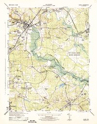
1944 Map of Laurel
USGS Topo · Published 1944About this map
The Patuxent River corridor during the mid-1940s reveals a landscape defined by significant federal institutional and military presence between Laurel and Bowie. Large tracts are dedicated to the Fort George G Meade Military Reservation and the sprawling Beltsville Research Center, where specific zones are labeled for agricultural studies including Swine, Goats, and Zoology. This era captures the region's transition into a specialized research and military hub, anchored by the Patuxent Refuge.
Find a feature on this map
55 named features on this map. Tap any name to fly to it.
Don’t see what you’re looking for? This feature index may not catch every label — zoom into the map to look around manually.
Map Details
Editions of this 1944 Laurel Map
This is the sole edition of this map. No revisions or reprints were ever made.
Other maps of this area

1892 · Laurel
USGS Topo · 1:62,500

1892 · Owensville
USGS Topo · 1:62,500

1894 · Laurel
USGS Topo · 1:62,500

1894 · Relay
USGS Topo · 1:62,500

1895 · Owensville
USGS Topo · 1:62,500

1897 · Laurel
USGS Topo · 1:62,500

1899 · Patuxent
USGS Topo · 1:125,000

1900 · Washington
USGS Topo · 1:62,500

1905 · Owensville
USGS Topo · 1:62,500

1906 · Patuxent
USGS Topo · 1:125,000