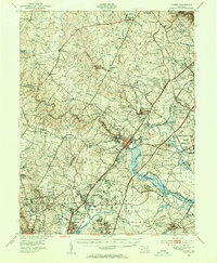
1949 Map of Laurel
USGS Topo · Published 1954About this map
The Little Patuxent River and Middle Patuxent River converge near Savage, anchoring a landscape defined by significant mid-century institutional and military footprints. This postwar era is captured just before the massive suburban expansion of the Baltimore-Washington corridor, showing the Beltsville Research Center and the Fort George G Meade Military Reservation as dominant features. Transport and infrastructure are central to the region's character, with the B & O RR and Pennsylvania RR cutting through the terrain, supporting local industry at the Patuxent Portland Station. In addition to the industrial and military presence, the map reveals a dense network of local civic life, featuring numerous country churches like Asbury Ch and educational institutions ranging from the Maryland State Teachers College to the Briarley Military Academy. Notable landmarks such as the Maryland House of Correction and the Patuxent Wildlife Refuge provide a clear view of how land was utilized for state and federal purposes during this period.
Find a feature on this map
125 named features on this map. Tap any name to fly to it.
Don’t see what you’re looking for? This feature index may not catch every label — zoom into the map to look around manually.
Map Details
Editions of this 1949 Laurel Map
2 editions found
Other maps of this area

1890 · Mt. Vernon
USGS Topo · 1:125,000

1891 · Mt. Vernon
USGS Topo · 1:125,000

1892 · Laurel
USGS Topo · 1:62,500

1892 · Ellicott
USGS Topo · 1:62,500

1892 · Owensville
USGS Topo · 1:62,500

1893 · Frederick
USGS Topo · 1:125,000

1894 · Ellicott
USGS Topo · 1:62,500

1894 · Laurel
USGS Topo · 1:62,500

1894 · Baltimore
USGS Topo · 1:62,500

1894 · Frederick
USGS Topo · 1:125,000