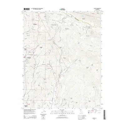
2015 Map of Laurel
USGS Topo · Published 2015About this map
The Santa Cruz Mountains and the trace of the San Andreas Fault define the complex topography of this 2015 study, where deep ravines like Caldwell Gulch and Ashbury Gulch cut through the landscape. The area shows a history of transit and settlement, anchored by the community of Laurel and the historic Tunnel Number 2, alongside the campus of Bethany Univ in Scotts Valley. Water management is prominent in the northern section, evidenced by the Williams Reservoir and Lake Elsman. Moving south toward Santa Cruz, the drainage network of Soquel Cr and Branciforte Cr shapes the residential patterns of Redwood Lodge and The Willows. This modern survey records the persistence of mountain communities and recreational spaces like the Soquel Demo Forest amidst the geologic fractures of the Coast Ranges.
Find a feature on this map
66 named features on this map. Tap any name to fly to it.
Don’t see what you’re looking for? This feature index may not catch every label — zoom into the map to look around manually.
Map Details
Editions of this 2015 Laurel Map
This is the sole edition of this map. No revisions or reprints were ever made.
Other maps of this area

1902 · Santa Cruz
USGS Topo · 1:125,000

1912 · Capitola
USGS Topo · 1:62,500

1914 · Capitola
USGS Topo · 1:62,500

1916 · New Almaden
USGS Topo · 1:48,000

1919 · New Almaden
USGS Topo · 1:62,500

1940 · Capitola
USGS Topo · 1:62,500

1940 · Los Gatos
USGS Topo · 1:62,500

1943 · Los Gatos
USGS Topo · 1:62,500

1947 · San Francisco
USGS Topo · 1:250,000

1947 · San Jose
USGS Topo · 1:250,000