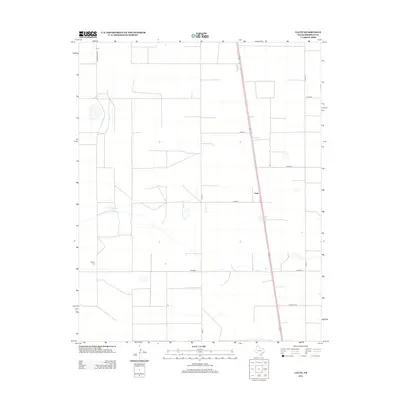
2012 Map of Lautz
USGS Topo · Published 2012About this map
Lautz sits at the intersection of local routes in this corner of Sherman County, where the landscape is defined by the regular grid of agricultural land and the drainage towards Elephant Lake. The map reveals a sparsely populated ranching and farming district, where large-scale operations are linked by an extensive network of county roads like Co Road U and Co Road Y. A significant genealogical landmark, the Whaley Cem, is situated in the southwestern quadrant, providing a fixed point for family history researchers in an area otherwise characterized by broad open tracts. The alignment of Farm Rd 1573 and the presence of specialized routes like Ranch Road 2014 reflect the infrastructure required to support the High Plains economy. This survey captures the rural character of the Texas Panhandle, showing the sparse but vital connections between remote homesteads and larger regional thoroughfares.
Find a feature on this map
12 named features on this map. Tap any name to fly to it.
Don’t see what you’re looking for? This feature index may not catch every label — zoom into the map to look around manually.
Map Details
Editions of this 2012 Lautz Map
This is the sole edition of this map. No revisions or reprints were ever made.
Other maps of this area

1954 · Perryton
USGS Topo · 1:250,000

1954 · Dalhart
USGS Topo · 1:250,000

1958 · Perryton
USGS Topo · 1:250,000

1958 · Dalhart
USGS Topo · 1:250,000

1962 · Dalhart
USGS Topo · 1:250,000

1963 · Cactus East
USGS Topo · 1:24,000

1964 · Brickel
USGS Topo · 1:24,000

1964 · Stevens SW
USGS Topo · 1:24,000

1964 · Stratford
USGS Topo · 1:24,000

1965 · Lautz
USGS Topo · 1:24,000