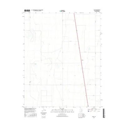
2016 Map of Lautz
USGS Topo · Published 2016About this map
Lautz and the surrounding high plains of Sherman County are defined by a rhythmic grid of rural roads and the north-south corridor of Route 287. The landscape is largely characterized by expansive agricultural tracts, punctuated by landmarks of local heritage such as the Whaley Cem located near the intersection of Co RD Y and FM 2014. This survey illustrates the geographic distribution of water features in an arid region, including Elephant Lake, alongside a systematic network of county roads like Co RD 7 and Co RD 10 that facilitate the movement of goods and people across the Panhandle. The alignment of the road system and the location of the cemetery offer clear spatial indicators of early ranching or farming patterns in this part of Texas.
Find a feature on this map
12 named features on this map. Tap any name to fly to it.
Don’t see what you’re looking for? This feature index may not catch every label — zoom into the map to look around manually.
Map Details
Editions of this 2016 Lautz Map
This is the sole edition of this map. No revisions or reprints were ever made.
Other maps of this area

1954 · Perryton
USGS Topo · 1:250,000

1954 · Dalhart
USGS Topo · 1:250,000

1958 · Perryton
USGS Topo · 1:250,000

1958 · Dalhart
USGS Topo · 1:250,000

1962 · Dalhart
USGS Topo · 1:250,000

1963 · Cactus East
USGS Topo · 1:24,000

1964 · Brickel
USGS Topo · 1:24,000

1964 · Stevens SW
USGS Topo · 1:24,000

1964 · Stratford
USGS Topo · 1:24,000

1965 · Lautz
USGS Topo · 1:24,000