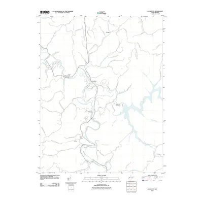
2011 Map of Lavalette
USGS Topo · Published 2011About this map
Twelvepole Creek and its many meandering tributaries define the landscape of this region south of Huntington in the early 21st century. The map centers on the community of Lavalette, where the creek system supports a network of small settlements including Dickson, Ardel, and Shoals. Local genealogy is well-represented through the locations of the Mount Vernon Cemetery and Smith Cemetery, while the presence of the Shoals Post Office indicates the enduring identity of these rural hubs. The eastern portion of the sheet is dominated by the waters of Beech Fork and the infrastructure of the Beech Fork Lake Dam. The terrain is characterized by a dense web of hollows and ridges, with family-named geographic features such as Medley Fork, Childers Branch, and Garrett Creek illustrating the long-standing community ties to the land.
Find a feature on this map
77 named features on this map. Tap any name to fly to it.
Don’t see what you’re looking for? This feature index may not catch every label — zoom into the map to look around manually.
Map Details
Editions of this 2011 Lavalette Map
This is the sole edition of this map. No revisions or reprints were ever made.
Other maps of this area

1892 · Huntington
USGS Topo · 1:125,000

1898 · Huntington
USGS Topo · 1:125,000

1901 · Guyandot
USGS Topo · 1:62,500

1901 · Ceredo
USGS Topo · 1:62,500

1902 · Guyandot
USGS Topo · 1:62,500

1903 · Kenova
USGS Topo · 1:125,000

1904 · Kenova
USGS Topo · 1:125,000

1909 · Wayne
USGS Topo · 1:62,500

1911 · Louisa
USGS Topo · 1:48,000

1913 · Ceredo
USGS Topo · 1:62,500