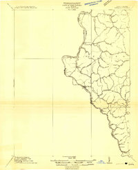
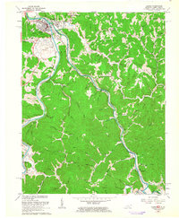
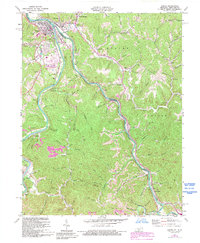
1911 Map of Louisa
USGS Topo · Published 1911About this map
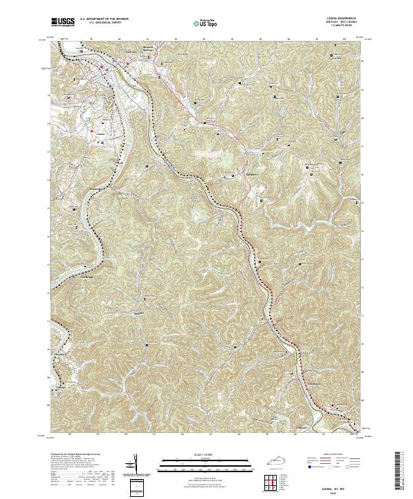
The Big Sandy River and its Tug Fork define the western edge of this 1911 survey, marking the essential border between Kentucky and West Virginia. The landscape is dominated by the narrow river valleys and the winding path of the Norfolk and Western Railway, which threads along the riverbanks to serve riverside settlements like Fort Gay, Prichard, and Glenhayes. This era shows a network of interior hollows and ridges, such as Wolf Pen Branch and Hurricane Creek, where small agrarian communities and family-named landmarks like Brick Church are connected by primitive roads. The map captures the region at a moment when industry was beginning to penetrate the hills via the rail lines, yet much of the area remained tied to local watercourses like Paddle Creek and Mull Creek. Researchers can trace the early layout of Hubbardstown and the isolated settlement at Saltpeter, providing a detailed look at Wayne County before significant modernization.
Find a feature on this map
41 named features on this map. Tap any name to fly to it.
Don’t see what you’re looking for? This feature index may not catch every label — zoom into the map to look around manually.
Map Details
Editions of this 1911 Louisa Map
This is the sole edition of this map. No revisions or reprints were ever made.
Historical Maps of Louisa Through Time
11 maps found
1911 Louisa
Lawrence County, KY
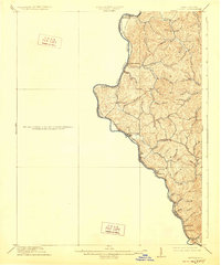
1913 Louisa
Lawrence County, KY
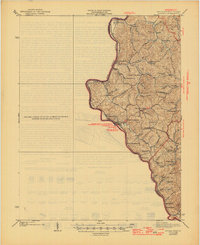
1939 Louisa
Lawrence County, KY
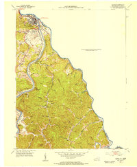
1953 Louisa
Lawrence County, KY
1962 Louisa
Lawrence County, KY
1971 Louisa
Lawrence County, KY
2011 Louisa
Lawrence County, KY
2013 Louisa
Lawrence County, KY
2016 Louisa
Lawrence County, KY
2019 Louisa
Lawrence County, KY
2022 Louisa
Lawrence County, KY