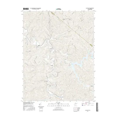
2016 Map of Lavalette
USGS Topo · Published 2016About this map
Twelvepole Creek winds through the heart of this Wayne County landscape, serving as the central drainage for a series of tight hollows and ridges. The settlement of Lavalette occupies the valley floor, surrounded by smaller communities such as Shoals, Dickson, and Ardel. The eastern edge of the area is dominated by the sprawling waters of Beech Fork Lake, where numerous fingers of the reservoir reach into tributary valleys like Stowers Br and Childers Br.
Find a feature on this map
118 named features on this map. Tap any name to fly to it.
Don’t see what you’re looking for? This feature index may not catch every label — zoom into the map to look around manually.
Map Details
Editions of this 2016 Lavalette Map
This is the sole edition of this map. No revisions or reprints were ever made.
Other maps of this area

1892 · Huntington
USGS Topo · 1:125,000

1898 · Huntington
USGS Topo · 1:125,000

1901 · Guyandot
USGS Topo · 1:62,500

1901 · Ceredo
USGS Topo · 1:62,500

1902 · Guyandot
USGS Topo · 1:62,500

1903 · Kenova
USGS Topo · 1:125,000

1904 · Kenova
USGS Topo · 1:125,000

1909 · Wayne
USGS Topo · 1:62,500

1911 · Louisa
USGS Topo · 1:48,000

1913 · Ceredo
USGS Topo · 1:62,500